Usage
geo_roads
Get all the roads in a specific region from OpenStreetMap.
usage: geo_roads.py [-h] [-c COUNTRY] [-l {1,2,3,4}] [-n NAME]
                    [-t TYPES [TYPES ...]] [-o OUTPUT] [-d DISTANCE]
                    [--no-header] [--plot]

Geo roads data

optional arguments:
  -h, --help            show this help message and exit
  -c COUNTRY, --country COUNTRY
                        Select country
  -l {1,2,3,4}, --level {1,2,3,4}
                        Select administrative level
  -n NAME, --name NAME  Select region name
  -t TYPES [TYPES ...], --types TYPES [TYPES ...]
                        Select road types (list)
  -o OUTPUT, --output OUTPUT
                        Output file name
  -d DISTANCE, --distance DISTANCE
                        Distance in meters to split
  --no-header           Output without header at the first row
  --plot                Plot the output
Output File Format
- segment_id - Unique ID (record number)
- osm_id - ID from Open Street Map data
- osm_name - Name from Open Street Map data (road name)
- osm_type - Type from Open Street Map data (road type)
- start_lat and start_long - Line segment start position (lat/long)
- end_lat and end_long - Line segment end position (lat/long)
Examples
To get a list of all the country names:
geo_roads
To get a list of all boundary names of Thailand at a specific administrative level:
geo_roads -c Thailand -l 1
In this case, all boundary names (77 provinces) at the 1st administrative divisions level of Thailand will be listed.
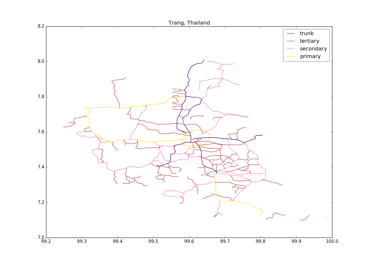
To get road data for the Trang province (only the road types trunk, primary, secondary and tertiary):
geo_roads -c Thailand -l 1 -n Trang -t trunk primary secondary tertiary --plot
Default output file will be saved as output.csv and all the road segments will be plotted if –plot is specified
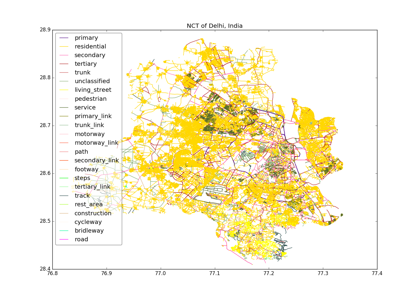
To run the script for Delhi of India and to save the output as delhi-roads.csv:
geo_roads -c India -l 1 -n "NCT of Delhi" -o delhi-roads.csv --plot
By default, all road types will be outputted if –types, -t is not specified.
sample_roads
Randomly sample a specific number of road segments of all roads or specific road types.
usage: sample_roads.py [-h] [-n SAMPLES] [-t TYPES [TYPES ...]]
                            [-o OUTPUT] [--no-header] [--plot]
                            input

Random sample road segments

positional arguments:
  input                 Road segments input file

optional arguments:
  -h, --help            show this help message and exit
  -n SAMPLES, --n-samples SAMPLES
                        Number of random samples
  -t TYPES [TYPES ...], --types TYPES [TYPES ...]
                        Select road types (list)
  -o OUTPUT, --output OUTPUT
                        Sample output file name
  --no-header           Output without header at the first row
  --plot                Plot the output
Examples
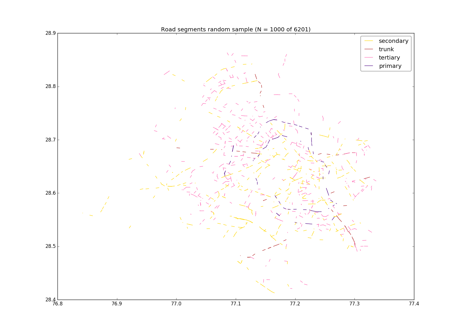
To get a random sample of 1,0000 road segments of road types primary, secondary, tertiary and trunk:
sample_roads -n 1000 -t primary secondary tertiary trunk -o delhi-roads-s1000.csv delhi-roads.csv
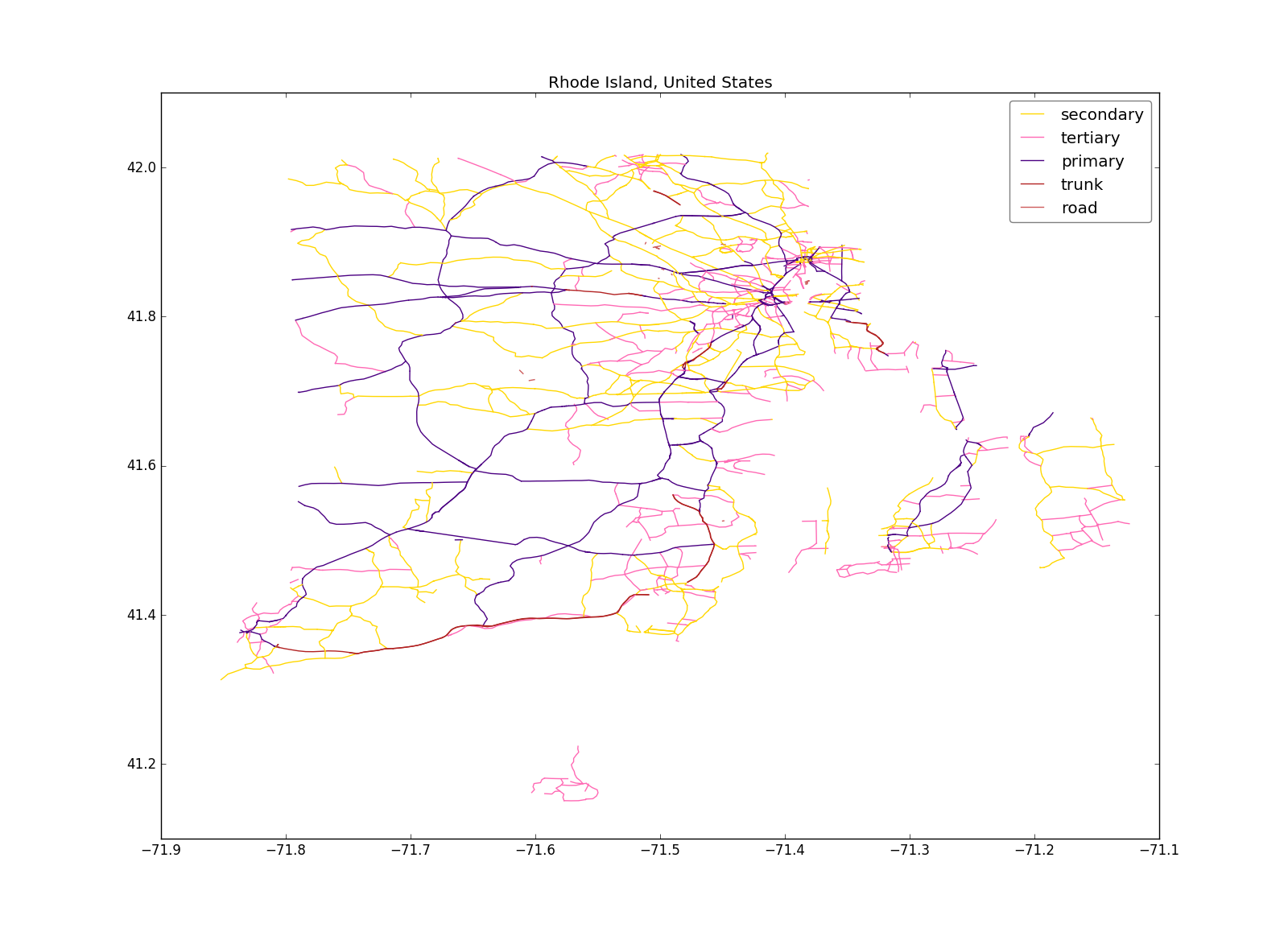
To get specific road types for Rhode Island in US:
geo_roads -c "United States" -l 1 -n "Rhode Island" -t trunk primary secondary tertiary road -o rhode-island-roads.csv --plot
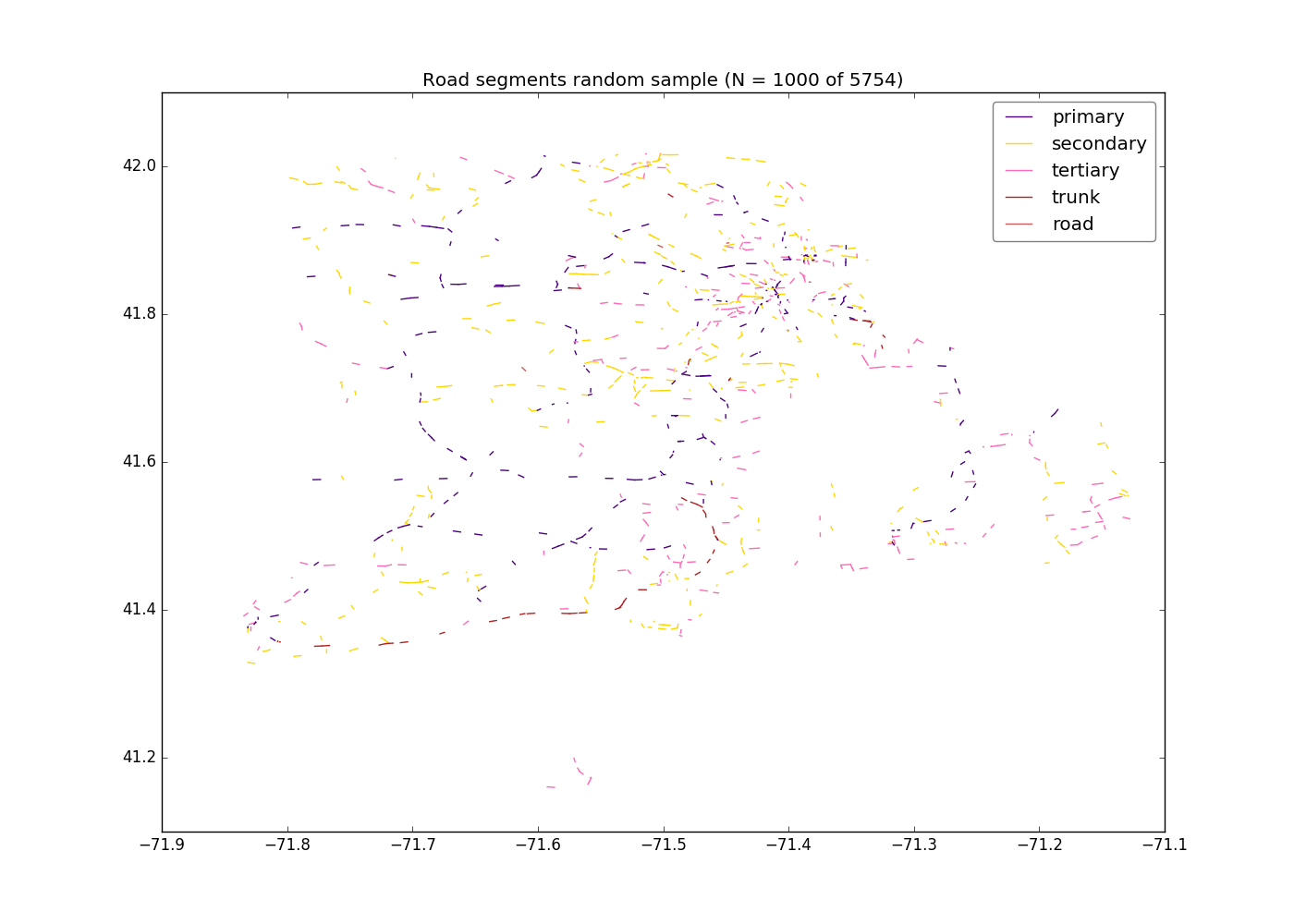
And then get a random sample of 1,000:
sample_roads -n 1000 -o rhode-island-s1000.csv --plot rhode-island-roads.csv
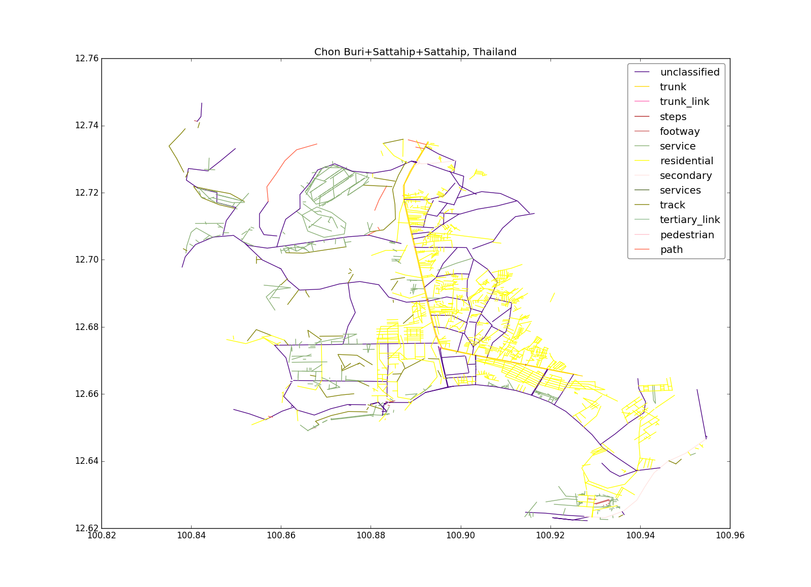
To get a specific region at 3rd adm. level (Tambon) of Thailand (e.g. “Tambon Sattahip, Amphoe Sattahip, Chon Buri, Thailand”):
geo_roads -c Thailand -l 3 -n "Chon Buri+Sattahip+Sattahip" -o sattahip-roads.csv --plot